Infrastructure Monitoring
NAYAN is deeply committed to enhancing citywide infrastructure
NAYAN is deeply committed to enhancing citywide infrastructureInfrastructure Monitoring
We collaborate closely with Municipalities and City Planners to identify and report issues such as uncollected garbage, illegal street settlements, and damaged public infrastructure. Our goal is to support local authorities in delivering more effective and responsive public services.
Building Better Cities, Together
At NAYAN, we believe in the power of technology to transform urban living. We partner with Municipalities and City Planners to proactively identify issues like uncollected waste, illegal encroachments, and damaged public infrastructure. By providing real-time insights, we help cities respond faster, plan smarter, and serve their communities better.
Smart Infrastructure Monitoring with AI & Computer VisionSmarter Cities Start with Smarter Insights
NAYAN uses advanced AI and Computer Vision to detect real-time events and pinpoint defects across infrastructure, public assets, and roadways — helping cities respond faster and plan better.
Key Capabilities:
- Cloud-Based Video & Image Analytics
- Real-Time Detection of Infrastructure Issues
- Enterprise-Ready On-Premise Deployments for Data-Sensitive Clients
- Scalable & Customizable Across Industries

FeaturesReal time insights and pinpoint defects
Enterprise ready deployments
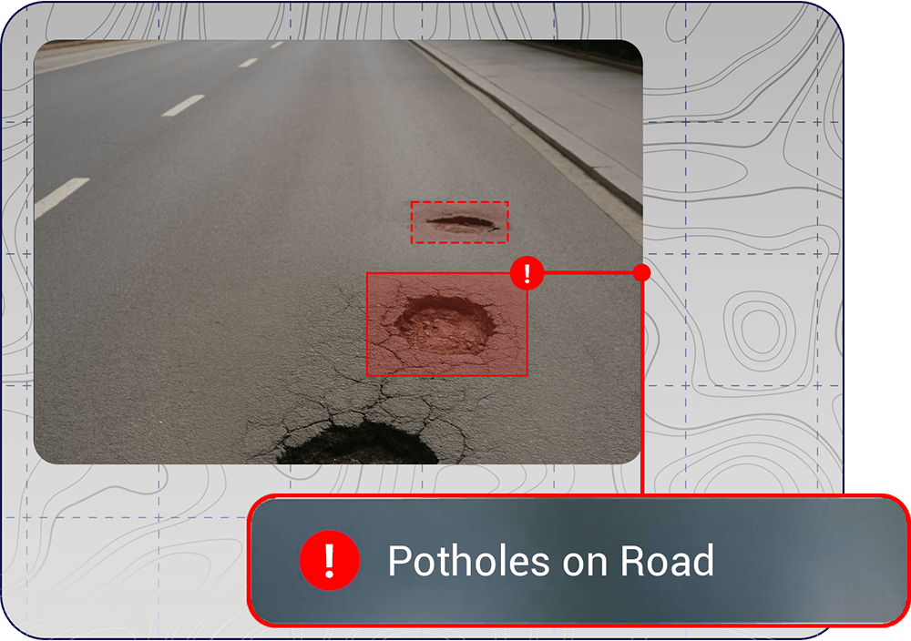
Road Surface Condition Detection
Construction Zone Monitoring
Bridge & Structure Observation
Captures and logs visual data of bridges, overpasses, and tunnels for maintenance planning and inspection support
Asset Inventory Tagging
Location-Based Anomaly Alerts
Sends alerts when infrastructure hazards (e.g., fallen signs, blocked drains) are detected in specific GPS-tagged locations
High-Definition Time-Lapse Capture
GIS MappingCity Coverage
Percentage Coverage of Cities increase from 0.1% Due to CCTV’s to 50% Due to AI Dashcams
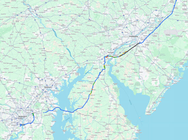
Washington
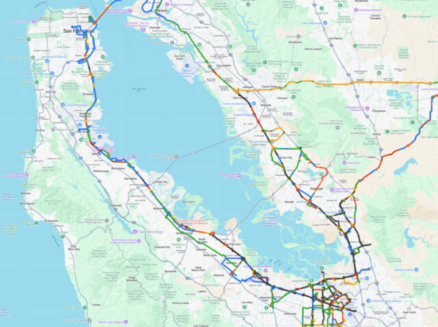
California
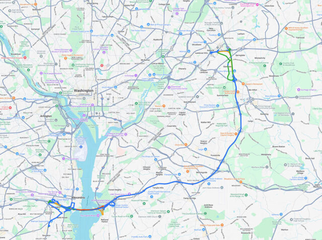
Huntington
FAQEverything you need
to know about Infrastructure Monitoring
Nayan detects garbage dumping, waterlogging, potholes, encroachments, and other civic violations impacting urban hygiene and safety.
By capturing and reporting garbage hotspots and illegal dumping sites via AI and GPS, and alerting the relevant authorities.
Yes, the system captures images of street encroachments and unauthorized activities and sends reports for municipal action.
Reports can be generated daily, weekly, or in real-time depending on the deployment plan, with summaries and heatmaps for efficient decision-making.
Nayan uses moving vehicles to automatically detect issues across large areas, saving time, cost, and manpower while ensuring higher coverage and consistency.